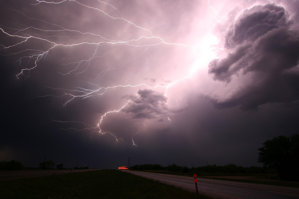
Warnings of thunderstorms are in place across swathes of the UK after some areas saw the longest stretch of high temperatures since the 1960s.
Yellow storm warnings apply to much of England, Wales, parts of Northern Ireland and south-west Scotland following highs of more than 30C.
There is a small chance of flooding, travel disruption and power cuts in those regions, the Met Office said.
It comes after torrential rain and lightning hit Scotland.
The yellow warning applies for Wales and the majority of England until Monday night next week.
The Met Office also warned of potential damage to buildings from lightning strikes or strong winds.
Forecaster Greg Dewhurst said the high temperatures triggering the thunderstorms could cause flooding.
“If rain is falling on places that have been quite hot and dry, and the ground is quite hard, the rain doesn’t have anywhere to go, and from that we can see flash flooding,”
“It’s still going to be warm and humid and that could then trigger some thunderstorms across parts of England and Wales through the afternoon and evening on Thursday
“Generally, the rest of the week remains unsettled with showers, some of them thundery and heavy, but there will still be some warm, sunny spells at times too.”
“It’s not often we get temperatures this high over several days, and that is triggering thunderstorms across parts of England and Wales.”
The warnings and alerts follow scorching temperatures in the UK.
The Met Office said temperatures surpassed 34C in central London for the sixth day in a row – the first time that has happened since at least 1961.
St James’s Park in the city saw a high of 34.6C.
